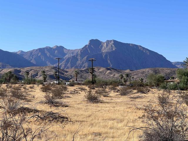
Borrego Springs
AdirtBorrego Springs, CA 92004
Lot Size
0.74 acres
Asking $/Acre
$13,514
Days on Market
44
Property Type
Land
HOA/mo
N/A
MLS ID
260023959SD
This property is in Borrego Springs (92004). View the Borrego Springs land market →
About This Property
This fine lot has great views of the surrounding mountains! There are no houses even close to this parcel on the west side of the road. Great views of Indian Head! orrego Springs is one of only a handful of International Dark Sky Communities in the world. Borrego Springs is located in the low desert unincorporated area of northeastern San Diego County. Borrego Springs is a winter resort destination and we welcome the "snow birds" who arrive from colder climates to warm up during the winter. Borrego Springs is less than a 2 hour drive from San Diego or Palm Springs. Borrego Springs is a village within a park, completely surrounded and protected by the Anza-Borrego Desert State Park, is the largest desert state park in the contiguous United States with over 660,000 acres. This desert community is miles away from the nearest stoplight and we have no big box or chain stores. The slower uncomplicated pace and the scenic beauty, add to your rustic, authentic, desert experience. It is a special place, in all seasons. Activities include, nature walks, off-roading, hiking, biking, watching the wildlife, photography or star gazing. Borrego Springs is an active community for young and old alike with a desirable small town atmosphere. The elevation of the Borrego Valley Airport is approximately 520'. The summers are very hot, the rest of the year is great! The winters are famous for good weather.
Location
Loading map...
What a Buyer Will Check
Caution: flood zone0.71 acres of vacant residential land on Borrego Springs Rd, county land with a Borrego Springs address, zoned RV, variable family residential, 10,000 sq ft lots. The ground is close to flat: lidar puts the median slope at 2%, and the soil survey calls it fine sand, somewhat excessively drained. Flood map: zone AO, 1% annual chance. It sits outside any fire zone. It has 112 ft of public street frontage on Borrego Springs Rd, with Borrego (Calif) Water District water. Sewer is unknown.
- Slopemedian 2%, 0% over 25%USGS 1 m lidar
- Soilfine sand, somewhat excessively drainedNRCS soil survey · Sep 11, 2026
- Floodzone AO, 1% annual chanceFEMA flood map · May 16, 2012
- Firenot in a hazard zoneCAL FIRE hazard zones
- Road frontage112 ft on Borrego Springs RdSanGIS rights of way · Nov 3, 2026
- ZoningRV, variable family residential, 10,000 sq ft lotsCounty of San Diego zoning · Apr 7, 2026
- Homes allowedabout 1 (2 per acre)County of San Diego zoning · Apr 7, 2026
- WaterBorrego (Calif) Water DistrictSANDAG water districts
- SewerUnknown: no answer in the public recordCounty sewer and septic screening · May 7, 2025
- Coastal ZoneoutsideSANDAG coastal zone
- Farm contractno farm contractCounty farm contracts
- Elevation664 ftUSGS 1 m lidar
From FEMA, USGS lidar, the USDA soil survey, CAL FIRE, SANDAG and county and city zoning, checked Nov 7, 2026. Public records, not a survey: confirm with the city or county before you buy.
Want to know more about this land or have questions?
Zoned Schools
Elementary
Borrego Springs Elementary · grades PK-5 · Borrego Springs Unified
Middle
Borrego Springs Middle · grades 6-8 · Borrego Springs Unified
High
Borrego Springs High · grades 9-12 · Borrego Springs Unified
The district's assigned schools for this parcel, from its attendance boundaries and rules. Boundaries change: confirm with the district before you buy.
- Lot size
- 32,234 sqft
- Asking $/acre
- $13,514
- Zip median $/acre (sold)
- $20,139
- Comp-implied value
- $15,012
Benchmarked against 2,880 sold-land comps (5-yr, recency-weighted) via zip price-size model · high confidence. Land value is site-specific — zoning, utilities, access, and buildability are not modeled. Not an appraisal.