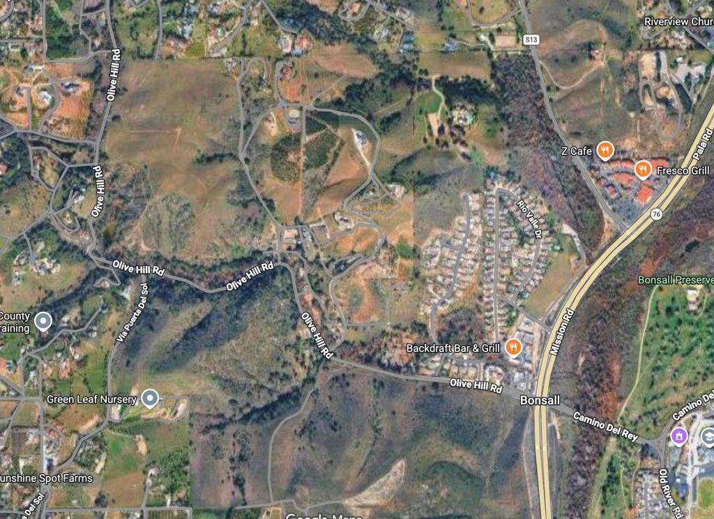
Olive Hill Rd Fallbrook
Fallbrook, CA 92028
Lot Size
—
Asking $/Acre
—
Days on Market
135
Property Type
Land
HOA/mo
N/A
MLS ID
260015747SD
This property is in Fallbrook (92028). View the Fallbrook land market →
About This Property
Discover Stallion Ridge, an exceptional investment opportunity comprising five distinct Assessor's Parcel Numbers (APNs). This expansive acreage features a large primary parcel that boasts sweeping, panoramic views stretching from the mountains all the way to the Pacific Ocean. The land offers highly usable, rolling topography complete with its own private lake and a scenic riparian forest area (streamside woodland). While located just minutes from Highway 76, the property feels remarkably quiet and secluded. It is ideal for an ultra-luxury private ranch, premier equestrian facilities, or potential subdivision. Stallion Ridge is easily accessible from coastal San Diego and Orange counties, as well as nearby Carlsbad (McClellan-Palomar) and Oceanside airports.
Location
Loading map...
What a Buyer Will Check
Caution: fireAbout 88.9 acres of vacant residential land on Olive Hill Rd, county land with a Fallbrook address, zoned RR, rural residential, 2-acre minimum lot. The zoning allows about 22 homes (1 per 4 acres). The ground slopes gently: lidar puts the median slope at 14%, with 9% of it over 25%, and the soil survey calls it sandy loam, well drained, very limited for houses. It sits outside the flood zone, in a Very High fire zone.
- Slopemedian 14%, 9% over 25%USGS 1 m lidar
- Soilsandy loam, well drained, very limited for housesNRCS soil survey · Sep 11, 2026
- Floodzone X, minimalFEMA flood map · May 16, 2012
- FireVery HighCAL FIRE hazard zones
- Road frontage1,729 ft on Olive Hill RdSanGIS rights of way · Nov 3, 2026
- ZoningRR, rural residential, 2-acre minimum lotCounty of San Diego zoning · Apr 7, 2026
- Homes allowedabout 22 (1 per 4 acres)County of San Diego zoning · Apr 7, 2026
- WaterRainbow Municipal Water DistrictSANDAG water districts
- SewerUnknown: no answer in the public recordCounty sewer and septic screening · May 7, 2025
- Coastal ZoneoutsideSANDAG coastal zone
- Farm contractno farm contractCounty farm contracts
- Elevation419 ft, 263 to 504 ft across the lotUSGS 1 m lidar
From FEMA, USGS lidar, the USDA soil survey, CAL FIRE, SANDAG and county and city zoning, checked Nov 7, 2026. Public records, not a survey: confirm with the city or county before you buy.
Want to know more about this land or have questions?
Zoned Schools
Elementary
Bonsall Elementary · grades K-5 · Bonsall Unified
Middle
Norman L. Sullivan Middle · grades 6-8 · Bonsall Unified
High
Bonsall High · grades 9-12 · Bonsall Unified
The district's assigned schools for this parcel, from its attendance boundaries and rules. Boundaries change: confirm with the district before you buy.
Analysis Not Available
Land listings don't have rental income projections.