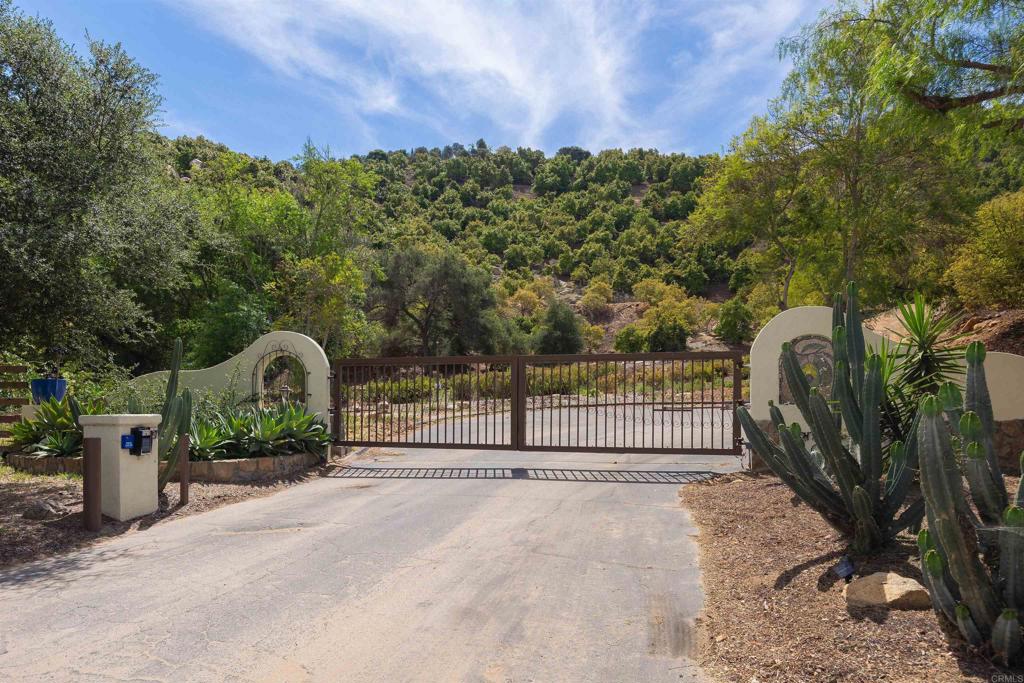
Luis Rey Heights Rd Bonsall
BdirtBonsall, CA 92003
Lot Size
11.98 acres
Asking $/Acre
$45,826
Days on Market
68
Property Type
Land
HOA/mo
$300
MLS ID
NDP2608303
This property is in Bonsall (92003). View the Bonsall land market →
About This Property
REDUCED..........PREMIUM ESTATE GROVE IN HIGHLY DESIREABLE SAN LUIS REY GROVES IN BONSALL. THIS RARE OPPORTUNITY INCLUDES LOVELY VIEWS COMBINED WITH INCOME GENERATING AGRICULTURE INCLUDING AVOCADOS TREES, PROTEA FLOWERS AND SILVER DOLLAR EUCALYPTUS. LOCATED IN AN UPSALE GATED NEIGHBORHOOD. THIS ONE-OF-A- KIND PARCEL IS READY FOR YOU TO BUILD YOUR DREAM HOME. PERC TESTS HAVE BEEN COMPLETED- SEPTIC LAYOUT COMPLETED AND A WATER METER IS INCLUDED IN THE SALE. THIS IS A UNIQUE OPPORTUNITY TO OWN A WORKING AGRICULTURAL ESTATE WITH LUXURY RESIDENTIAL POSSIBILITIES. THERE IS A 1200 SF NEW METAL BUILDING THAT IS ON THE PROPERTY BUT NOT YET CONSTRUCTED THAT CAN BE PURCHASED WITH THE PARCEL
Location
Loading map...
What a Buyer Will Check
Caution: fire, hillsideAbout 11.9 acres of farm land on Luis Rey Heights Rd, county land with a Bonsall address, zoned RR, rural residential, 4-acre minimum lot. Most of it is steep: lidar puts the median slope at 34%, with 74% of it over 25%, and the soil survey calls it rocky sandy loam, somewhat excessively drained, very limited for houses. It sits outside the flood zone, in a Very High fire zone. No public road frontage was found. Water comes from Rainbow Municipal Water District. Septic likely.
- Slopemedian 34%, 74% over 25%, about 3.1 acres under 25%USGS 1 m lidar
- Soilrocky sandy loam, somewhat excessively drained, very limited for housesNRCS soil survey · Sep 11, 2026
- Floodzone X, minimalFEMA flood map · May 16, 2012
- FireVery HighCAL FIRE hazard zones
- Road frontageno public road frontage foundSanGIS rights of way · Nov 3, 2026
- ZoningRR, rural residential, 4-acre minimum lotCounty of San Diego zoning · Apr 7, 2026
- Homes allowedabout 1 (1 per 20 acres on this slope)County of San Diego zoning · Apr 7, 2026
- WaterRainbow Municipal Water DistrictSANDAG water districts
- Sewerseptic likelyCounty sewer and septic screening · May 7, 2025
- Coastal ZoneoutsideSANDAG coastal zone
- Farm contractno farm contractCounty farm contracts
- Elevation411 ft, 287 to 561 ft across the lotUSGS 1 m lidar
From FEMA, USGS lidar, the USDA soil survey, CAL FIRE, SANDAG and county and city zoning, checked Nov 7, 2026. Public records, not a survey: confirm with the city or county before you buy.
Want to know more about this land or have questions?
Zoned Schools
Elementary
Bonsall Elementary · grades K-5 · Bonsall Unified
Middle
Norman L. Sullivan Middle · grades 6-8 · Bonsall Unified
High
Bonsall High · grades 9-12 · Bonsall Unified
The district's assigned schools for this parcel, from its attendance boundaries and rules. Boundaries change: confirm with the district before you buy.
- Lot size
- 11.98 acres
- Asking $/acre
- $45,826
- Zip median $/acre (sold)
- $60,000
- Comp-implied value
- $475,721
- Oct 31, 2026$575,000 → $549,000-4.5%
Benchmarked against 2,889 sold-land comps (5-yr, recency-weighted) via zip price-size model · high confidence. Land value is site-specific — zoning, utilities, access, and buildability are not modeled. Not an appraisal.