Cristo Rey Bonsall
AdirtBonsall, CA 92003
Lot Size
4.66 acres
Asking $/Acre
$32,189
Days on Market
91
Property Type
Land
HOA/mo
N/A
MLS ID
SW26175918
This property is in Bonsall (92003). View the Bonsall land market →
About This Property
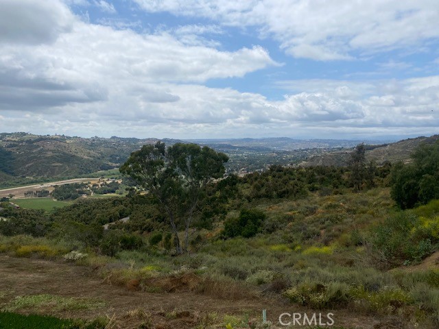
Incredible opportunity to own approximately 4.66 acres in the highly desirable community of Bonsall! Set on an elevated hillside surrounded by beautiful custom and million-dollar homes, this unique parcel offers spectacular panoramic views of the surrounding hills, valleys and countryside. The elevated setting and natural terrain create a wonderful sense of privacy while still being conveniently located near area amenities and major transportation routes. Located off Highway 395 with access via Via Urner/Aquaduct Road, the property offers a rare opportunity for a buyer looking to create a private hillside retreat in one of North San Diego County’s most scenic communities. Water and electricity are reported nearby but are not currently on the property. Zoned A70 per prior listing information. Buyers are encouraged to independently verify zoning, allowable uses, utilities, access, easements, septic requirements, building requirements and development potential with the County of San Diego and appropriate agencies. (See Supplements for past Survey.)**Also available separately is the adjacent approximately 36.78-acre parcel, offering an opportunity to purchase one or both properties. Don’t miss this chance to own a substantial piece of land in beautiful Bonsall with tremendous views and custom homes nearby.
Location
Loading map...
What a Buyer Will Check
Caution: fire, hillsideAbout 4.6 acres of vacant residential land on Cristo Rey, county land with a San Diego address, zoned A70, limited agriculture, 2-acre minimum lot. Most of it is steep: lidar puts the median slope at 37%, with 88% of it over 25%, and the soil survey calls it cieneba-rock outcrop complex, somewhat excessively drained, very limited for houses. It sits outside the flood zone, in a Very High fire zone. No public road frontage was found. Water comes from Rainbow Municipal Water District. Sewer is unknown.
- Slopemedian 37%, 88% over 25%, about 24,300 sq ft under 25%USGS 1 m lidar
- Soilcieneba-rock outcrop complex, somewhat excessively drained, very limited for housesNRCS soil survey · Sep 11, 2026
- Floodzone X, minimalFEMA flood map · May 16, 2012
- FireVery HighCAL FIRE hazard zones
- Road frontageno public road frontage foundSanGIS rights of way · Nov 3, 2026
- ZoningA70, limited agriculture, 2-acre minimum lotCounty of San Diego zoning · Apr 7, 2026
- Homes allowedabout 1 (1 per 8 acres on this slope)County of San Diego zoning · Apr 7, 2026
- WaterRainbow Municipal Water DistrictSANDAG water districts
- SewerUnknown: no answer in the public recordCounty sewer and septic screening · May 7, 2025
- Coastal ZoneoutsideSANDAG coastal zone
- Farm contractno farm contractCounty farm contracts
- Elevation500 ft, 426 to 602 ft across the lotUSGS 1 m lidar
From FEMA, USGS lidar, the USDA soil survey, CAL FIRE, SANDAG and county and city zoning, checked Nov 7, 2026. Public records, not a survey: confirm with the city or county before you buy.
Want to know more about this land or have questions?
Zoned Schools
Elementary
Bonsall Elementary · grades K-5 · Bonsall Unified
Middle
Norman L. Sullivan Middle · grades 6-8 · Bonsall Unified
High
Bonsall High · grades 9-12 · Bonsall Unified
The district's assigned schools for this parcel, from its attendance boundaries and rules. Boundaries change: confirm with the district before you buy.
- Lot size
- 4.66 acres
- Asking $/acre
- $32,189
- Zip median $/acre (sold)
- $106,509
- Comp-implied value
- $361,192
Benchmarked against 2,889 sold-land comps (5-yr, recency-weighted) via zip price-size model · high confidence. Land value is site-specific — zoning, utilities, access, and buildability are not modeled. Not an appraisal.