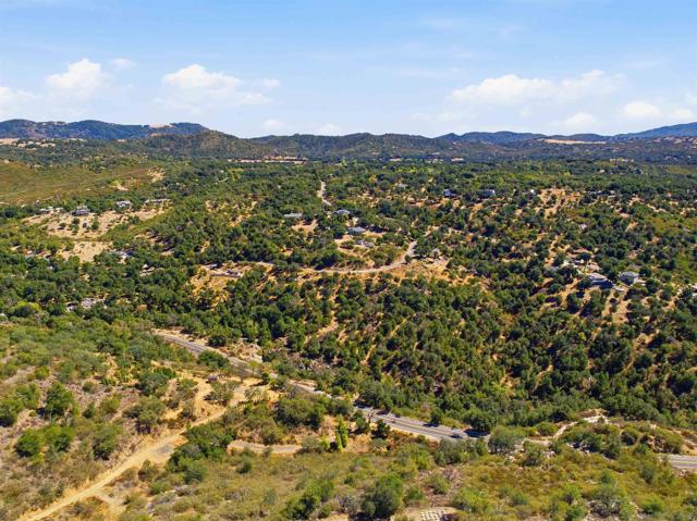
80 Riverwood Rd
AdirtSanta Ysabel, CA 92070
Lot Size
9.53 acres
Asking $/Acre
$10,388
Days on Market
45
Property Type
Land
HOA/mo
N/A
MLS ID
260024173SD
This property is in Santa Ysabel (92070). View the Santa Ysabel land market →
About This Property
Location, location, location -AND- water, water, water!! THREE buildable adjacent lots (9.53 acres) in Wynola Estates, a "private mountain community" perfectly situated just outside the historic town of Julian. Each parcel comes with PAID water meters available from Wynola Water District, septic layouts for APNs 248-242-11-00 and 248-242-09-00, power nearby and direct paved road access. Riverwood Rd is elevated giving each lot stunning south-westerly panoramic views. Come build your dream home and enjoy the perfect balance of privacy, convenience, serenity and recreation. - APNs from north to south: 248-242-11-00 (Lot 80), APN 248-242-10-00 (Lot 79), APN 248-242-09-00 (Lot 78).
Location
Loading map...
What a Buyer Will Check
Caution: fire, hillsideAbout 2.8 acres of vacant residential land on Riverwood Rd, county land with a Santa Ysabel address, zoned RR, rural residential, 2-acre minimum lot. Most of it is steep: lidar puts the median slope at 29%, with 59% of it over 25%, and the soil survey calls it stony coarse sandy loam, well drained, very limited for houses. It sits in a Very High fire zone; the flood zone is unknown.
- Slopemedian 29%, 59% over 25%, about 1.1 acres under 25%USGS 1 m lidar
- Soilstony coarse sandy loam, well drained, very limited for housesNRCS soil survey · Sep 11, 2026
- Floodzone D, flood risk not studiedFEMA flood map · May 16, 2012
- FireVery HighCAL FIRE hazard zones
- Road frontage614 ft on State Route 78 and Riverwood RdSanGIS rights of way · Nov 3, 2026
- ZoningRR, rural residential, 2-acre minimum lotCounty of San Diego zoning · Apr 7, 2026
- Homes allowedabout 1 (1 per 4 acres on this slope)County of San Diego zoning · Apr 7, 2026
- WaterWynola (Calif) Water DistrictSANDAG water districts
- SewerUnknown: no answer in the public recordCounty sewer and septic screening · May 7, 2025
- Coastal ZoneoutsideSANDAG coastal zone
- Farm contractno farm contractCounty farm contracts
- Elevation3,342 ft, 3,289 to 3,417 ft across the lotUSGS 1 m lidar
From FEMA, USGS lidar, the USDA soil survey, CAL FIRE, SANDAG and county and city zoning, checked Nov 7, 2026. Public records, not a survey: confirm with the city or county before you buy.
Want to know more about this land or have questions?
Zoned Schools
Elementary
Spencer Valley Elementary · grades K-8 · Spencer Valley Elementary
Middle
Spencer Valley Elementary · grades K-8 · Spencer Valley Elementary
High
Julian High · grades 9-12 · Julian Union High
The district's assigned schools for this parcel, from its attendance boundaries and rules. Boundaries change: confirm with the district before you buy.
- Lot size
- 9.53 acres
- Asking $/acre
- $10,388
- Zip median $/acre (sold)
- $11,381
- Comp-implied value
- $163,946
Benchmarked against 2,871 sold-land comps (5-yr, recency-weighted) via zip price-size model · high confidence. Land value is site-specific — zoning, utilities, access, and buildability are not modeled. Not an appraisal.