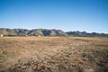
37660 Montezuma Valley Road
DdirtRanchita, CA 92066
Lot Size
7.20 acres
Asking $/Acre
$68,750
Days on Market
45
Property Type
Land
HOA/mo
N/A
MLS ID
NDP2609147
This property is in Ranchita (92066). View the Ranchita land market →
About This Property
Spanning three combined parcels (APN: 196-110-13, 196-110-14, and 196-110-15), this versatile property offers impressive space, privacy, and infrastructure already in place. Entirely fully fenced, the acreage features two private water wells and nearby underground power hookups, drastically reducing the time and expense required for future improvement. An existing, non-operational manufactured home sits on site, presenting a potential fixer project, a temporary headquarters, or a footprint for your future custom build. Framed by expansive neighborhood and mountain views, this rural sanctuary is perfect for agricultural production, livestock, recreational use, or building your own retreat. Enjoy the quiet serenity of high-country desert living while remaining within easy reach of Julian and Borrego Springs.
Location
Loading map...
What a Buyer Will Check
Caution: fire, no frontageAbout 3.8 acres of land on Montezuma Valley Rd, county land with a Ranchita address, zoned A70, limited agriculture, 8-acre minimum lot. The ground is close to flat: lidar puts the median slope at 5%, and the soil survey calls it coarse sandy loam, well drained. It sits in a Very High fire zone; the flood zone is unknown. No public road frontage was found. No water district, a well would be needed. Septic likely.
- Slopemedian 5%, 0% over 25%USGS 1 m lidar
- Soilcoarse sandy loam, well drainedNRCS soil survey · Sep 11, 2026
- Floodzone D, flood risk not studiedFEMA flood map · May 16, 2012
- FireVery HighCAL FIRE hazard zones
- Road frontageno public road frontage foundSanGIS rights of way · Nov 3, 2026
- ZoningA70, limited agriculture, 8-acre minimum lotCounty of San Diego zoning · Apr 7, 2026
- Homes allowedabout 1 (1 per 10 acres)County of San Diego zoning · Apr 7, 2026
- Waterno water district, a well would be neededSANDAG water districts
- Sewerseptic likelyCounty sewer and septic screening · May 7, 2025
- Coastal ZoneoutsideSANDAG coastal zone
- Farm contractno farm contractCounty farm contracts
- Elevation4,078 ft, 4,058 to 4,095 ft across the lotUSGS 1 m lidar
From FEMA, USGS lidar, the USDA soil survey, CAL FIRE, SANDAG and county and city zoning, checked Nov 7, 2026. Public records, not a survey: confirm with the city or county before you buy.
Want to know more about this land or have questions?
Zoned Schools
Elementary
Warner Elementary · grades K-6 · Warner Unified
Middle
Warner Junior/Senior High · grades 7-12 · Warner Unified
High
Warner Junior/Senior High · grades 7-12 · Warner Unified
The district's assigned schools for this parcel, from its attendance boundaries and rules. Boundaries change: confirm with the district before you buy.
- Lot size
- 7.20 acres
- Asking $/acre
- $68,750
- Zip median $/acre (sold)
- $11,447
- Comp-implied value
- $100,331
Benchmarked against 2,880 sold-land comps (5-yr, recency-weighted) via zip price-size model · high confidence. Land value is site-specific — zoning, utilities, access, and buildability are not modeled. Not an appraisal.