2202 Calle Dos Lomas
CdirtFallbrook, CA 92028
Lot Size
1.74 acres
Asking $/Acre
$200,001
Days on Market
60
Property Type
Land
HOA/mo
$600
MLS ID
NDP2608538
This property is in Fallbrook (92028). View the Fallbrook land market →
About This Property
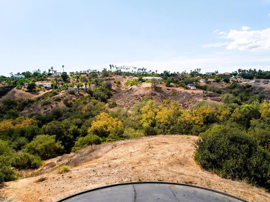
NEW LOWER PRICE—Imagine Your Future Home with Beautiful Southwesterly Views! Tucked at the end of a quiet cul-de-sac just outside the gated community of Champagne Crest, this Fallbrook homesite offers beautiful views and the welcoming setting of a mature, established neighborhood. Available approved grading plans and plans for an approximately 2,100-square-foot, single-level home plus garage provide a starting point for your vision—or bring your own plans and create a home that suits your lifestyle. A three-quarter-inch water meter is in place, with utilities at the curb. A previously approved septic plan is also available and will require updating. An inviting opportunity to build your next chapter in a beautiful corner of Fallbrook. Listing is for land only. The house pictured is a concept rendering, not an existing home. Buyer to verify all information, including the current status of plans and approvals, utility availability, and building requirements, during the investigation period.
Location
Loading map...
What a Buyer Will Check
Caution: fire, hillsideAbout 1.7 acres of vacant residential land on Calle Dos Lomas, county land with a Fallbrook address, zoned A70, limited agriculture, 2-acre minimum lot. Most of it is steep: lidar puts the median slope at 35%, with 76% of it over 25%, and the soil survey calls it coarse sandy loam, well drained, very limited for houses. It sits outside the flood zone, in a High fire zone. No public road frontage was found. Water comes from Rainbow Municipal Water District. Sewer is unknown.
- Slopemedian 35%, 76% over 25%, about 18,100 sq ft under 25%USGS 1 m lidar
- Soilcoarse sandy loam, well drained, very limited for housesNRCS soil survey · Sep 11, 2026
- Floodzone X, minimalFEMA flood map · May 16, 2012
- FireHighCAL FIRE hazard zones
- Road frontageno public road frontage foundSanGIS rights of way · Nov 3, 2026
- ZoningA70, limited agriculture, 2-acre minimum lotCounty of San Diego zoning · Apr 7, 2026
- Homes allowedabout 1 (1 per 4 acres on this slope)County of San Diego zoning · Apr 7, 2026
- WaterRainbow Municipal Water DistrictSANDAG water districts
- SewerUnknown: no answer in the public recordCounty sewer and septic screening · May 7, 2025
- Coastal ZoneoutsideSANDAG coastal zone
- Farm contractno farm contractCounty farm contracts
- Elevation544 ft, 494 to 583 ft across the lotUSGS 1 m lidar
From FEMA, USGS lidar, the USDA soil survey, CAL FIRE, SANDAG and county and city zoning, checked Nov 7, 2026. Public records, not a survey: confirm with the city or county before you buy.
Want to know more about this land or have questions?
Zoned Schools
Elementary
Bonsall Elementary · grades K-5 · Bonsall Unified
Middle
Norman L. Sullivan Middle · grades 6-8 · Bonsall Unified
High
Bonsall High · grades 9-12 · Bonsall Unified
The district's assigned schools for this parcel, from its attendance boundaries and rules. Boundaries change: confirm with the district before you buy.
- Lot size
- 1.74 acres
- Asking $/acre
- $200,001
- Zip median $/acre (sold)
- $115,132
- Comp-implied value
- $226,311
- Oct 6, 2026$398,000 → $348,000-12.6%
Benchmarked against 2,889 sold-land comps (5-yr, recency-weighted) via zip price-size model · high confidence. Land value is site-specific — zoning, utilities, access, and buildability are not modeled. Not an appraisal.